(Upload on March 1 2019) [ 日本語 | English ]
Mount Usu / Sarobetsu post-mined peatland
From left: Crater basin in 1986 and 2006. Cottongrass / Daylily
HOME > Lecture catalog / Research summary > Glossary > Geography
Earth science (地球科学)Any of the sciences that deal with the earth or with one or more of its partsEearth planetary science includes planetary sicence on solar system Earth consisting of four spheres
Geophysics (地球物理学)= geochemistry (地球化学) + biogeochemistry (生物地球化学)→ Introcution to global warming (地球温暖化総論) → Seminar: Carbon dynamics viewing through volcanoes and wetlands (火山・湿原群集を通してみた炭素動態) |
[ earth science | microtopography ] periglacial landforms[ wind cave ( 風穴 )| drift ice ] |
|
≈ geographical features, the lay of the land |
Tableland or plataeu (台地) (terrace, 段丘)River terrace (河岸段丘) = fluvial terrace and stream terraceCoast(al) terrace (海岸段丘) = marine terrace, sea terrace and shore terrace |
Any areas udner a tundra climate, including alpine zones, or where frozen-thawing processes are active or permafrost occurs.
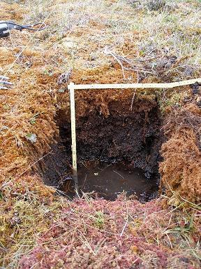
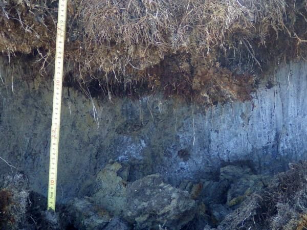
Layer of soil or rock at some depth beneath the ground surface in which the temperature has been continuously below 0°C for at least a few years.
 1
1
 2
2
 3
3
 4
4
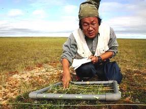
[1] under the water, it was frozon. [2] palsa developed on the permafrost. [3] vegetation survey conducted on the palsa (see below). At Arctic National Wildlife Refuge (ANWR) in early August 2006. [4] along Dalton Highway, interior Alaska, on August 4 2014.
|
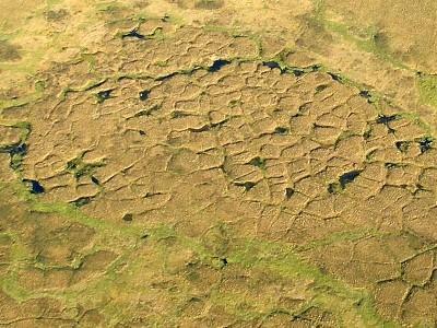
→ formed by contraction cracks enlarged by ice wedges Low-center polygon: a polygonal shape of raised edges, the pressure created by an ice wedge forces the soil around the crack upward to form two small ridges as much as 0.5 m tall. In poorly drained sites, water fills the center of the polygon and the center of the ice-wedge troughs. Collected water efficiently conducts heat from sunlight so it melts underlying permafrost, which causes additional slumping. |
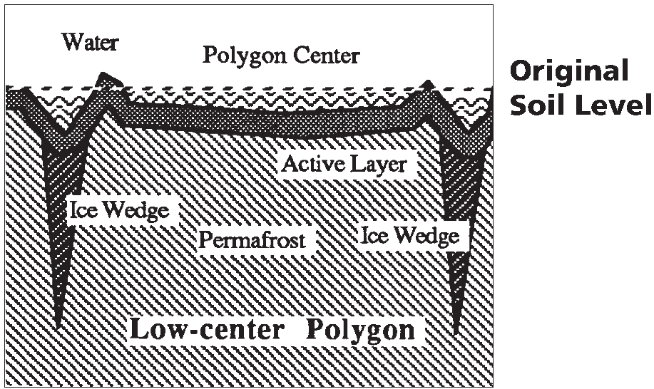 As the water-filled troughs and centers enlarge and deepen, they eventually meet to form a small lake. When the lake is drained, or filled in with organic material, a new low-center polygon forms. Over a period of hundreds of years, poorly drained sites gradually cycle between flooded low-center polygons and small lakes. |
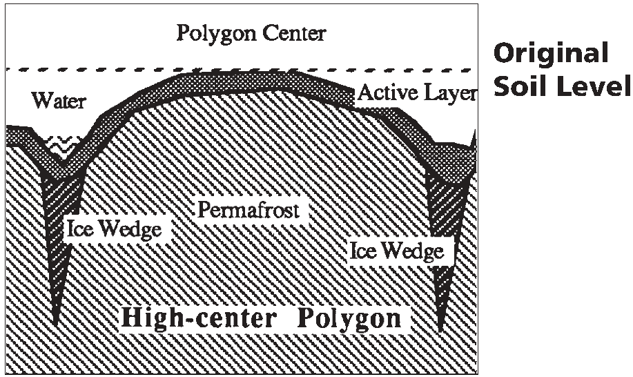 High-center polygon: In well-drained soil, the troughs around a low-center polygon enlarge and sink, while the center remains in place. It appears that the center of the polygon has raised, when actually, the troughs have sunk. The center may be 1.5 m above the bottom of the troughs. As the thermokarst slumping caused by the growing troughs continues, the mound may eventually collapse, too. |
Large masses of ice growing in thermal contraction cracks in permafrost zones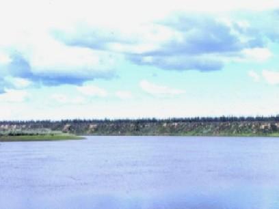
Gullies developed by ice wedges along Kolyma River, northern Siberia Vegetation structure was surveyed in gullies developed by the melting of ice wedges along the Kolyma River, northern Siberia, using 72 50 × 50 cm plots. The mean total plant cover was approximately 50% on gley soils, which were only distributed in the gullies. Based on twinspan cluster analysis, four vegetation types were recognized: (i) Agrostis purpurascens grassland with Ceratodon purpureus moss carpet; (ii) Matricaria matricarioides forbland; (iii) Chamaenerium angustifolium and M. matricarioides forbland; and (iv) Descurainia sophia grassland. Species that produce seeds capable of long-distance dispersal established well. Of the environmental factors surveyed, the gully scales (height and width) and elevational difference within a plot were primarily related to the vegetation development. The gully height was correlated with soil pH and compaction that might be related to intensities of ground surface disturbances. Agrostis purpurascens established in large gullies, while Equisetum arvense and Salix alaxensis established in small gullies. Soil compaction was also related to the vegetation establishment patterns (e.g. Rumex sibirica did not establish on hard soils). We concluded that the gully scales primarily determine soil conditions, including ground surface instability as a function of slope and soil compaction, and subsequent community structure. |
 Schematic representation of the evolution of an ice wedge according to the contraction-crack theory. The crack is exaggerated for illustrative purposes. Diagram modified slightly from Lachenbruch (1962). |
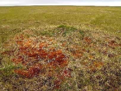
| A low oval elevation containing permanently-frozen ice lens in (discontinuous) permafrost zones, < pingo (Nelson et al. 1985) |
often covered with peat bogs Age: 100-2,000 years |
 1 1
 2 2
= hydrolaccolith = bulgunniakh (Sakha) A pingo (small hill, inuit language) is a periglacial landform of earth-covered ice mound. Therefore the distribution is restricted in the Arctic, subarctic, and Antarctica. The size reaches < 70 metres high and < 2 km wide. Age: 100-10,000 years Closed-system pingo= Hydrostatic pingoforms as a result of hydrostatic pressure on water from permafrost, and commonly forms in drained lake or river channel Open-system pingos= Hydraulic pingoresults from groundwater flowing from an outside source, i.e. subpermafrost or intrapermafrost aquifers Pingo in northeastern SiberiaA pingo is cocvered by a coniferous forest. The pingo was observed along Kolyma River on July 16, 1995 (my birthday). The ground surface is covered with Sphagnum spp. that was frozen. |
 Fig. Distribution of pingo in Alaska |
 1 1 |
 2 2 |
Yedoma (ice complex) is organic-rich Pleistocene loess permafrost, containing methane (one of the global warming gases). Therefore, global warming may promote a positive feedback, due to melting yedoma. Yedoma is closely related to the development of ice wedge. [1] Bob Sento collected ice samples for measure dating Yedoma. The survey was conducted along East Siberian Sea near Ambarchik on August 13 1996. [2] We can see baidzharakhs in the backyard of yedoma. |
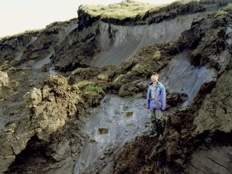
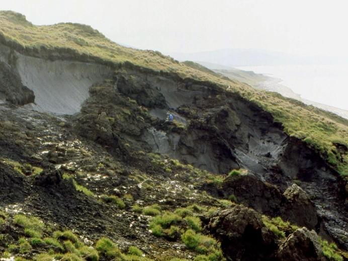
Baidzharakhs, baidzherakhs or baydjarakhs (Sakha language) develop on coastal terraces in the northern Siberian arctic tundra (ツンドラ) facing the Arctic Ocean, and develop around ice wedges and edomas. A network of baidzharakhs is derived from frozen thermo-erosional mounds in the permafrost zone. A baidzharakh is a mound several meters high and 3-12 m wide. It is the residual shell formed by the melting of ice wedges in polygonal ground. However, the formation processes have various developmental pathways, including abundant ice pillars covered by a frozen earth layer occurring on glacial terraces, and washing out by flows of earthy veins.
To understand how baidzharakhs (relic mounds enclosing polygonal ice blocks in permafrost) aVect the zonal distribution of vegetation, vegetation was measured in 145 plots of area 50 cm × 50 cm on a coastal terrace facing the Arctic Ocean in northern Siberia. Cluster analysis classified five community types that were zonally distributed along the coastline. α-diversities (species richness and diversity) were not different among vegetation types except for vegetation close to the coastline. On and around baidzharakhs, burrows created by lemmings were frequently observed, and plant cover was low, suggesting that baidzharakhs support habitats for rodents. Disturbances by rodent habits caused plant cover to decline but did not change α-diversity. Two vegetation types that developed only on baidzharakhs were found at intermediate distances between the seacoast and inland areas. Because these two vegetation types are azonally distributed, β- and γ-diversities were increased by permafrost-derived topography, i.e., baidzharakh, and/or disturbance by rodents of which suitable nesting habitat is provided by baidzharakh.
|
= Sakha language (shallow depression) formed by subsidence of the permafrost due to repeated melting and refreezing
1) shallow lake developed by melting water Size: several tens of meters to several kilometers in diameter |
 An alas at Spasskaya Pad near Yakutsk, Sakha Republic on August 7 1996
|
 1 1 |
 2 2 |
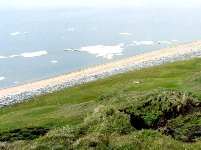
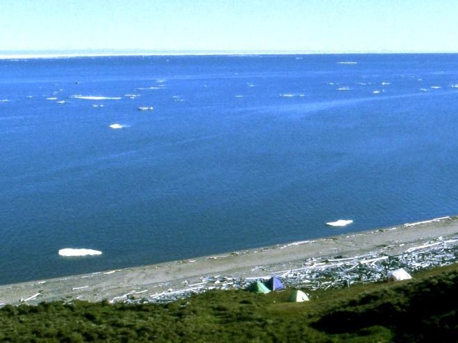
not concerned with periglacial landforms one of the sea ice floating on the surface of the sea. The distribution of drift ice is greatly determined by winds and sea currents.Northeastern Siberia along the Arctic SeaDrift ice I saw in August! The photos were taken on August 13 [1] and 14 [2], 1996. One day, the seashore was completely covered with ice along East Siberian Sea near Ambarchik where we surveyed vegetation and yeadoma. [2] There are three tents we used. |
|
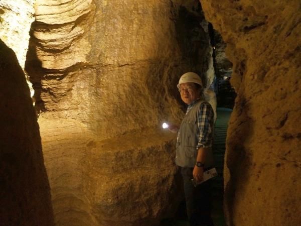
= karst, karst landscape and karst topography A landscape formed mostly from the dissolution of soluble rocks such as limestone, dolomite and gypsum → underground drainage systems Karst-related topography
|
Doline
|
[volcanology (火山学), volcanoes (火山), lava (溶岩)]
|
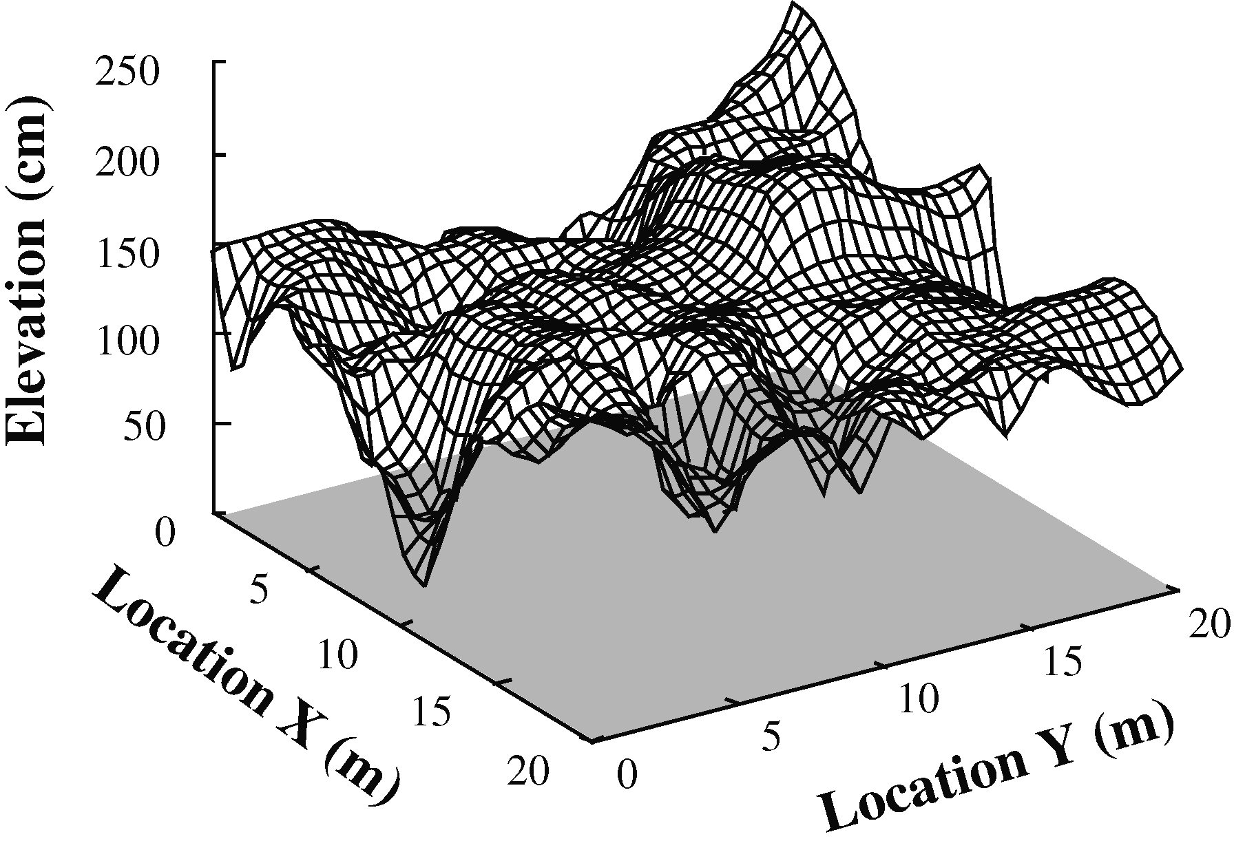
micro- (prefix): extremely small topography (un): the shape of an area of land, including its hills, valleys etc. MicrohabitatA fine-scaled habitat with different environmental conditions from those of the surrounding area, e.g., wihtin-tussocks (Koyama & Tsuyuzaki 2010), and near-rocks (Titus & Tsuyuzaki 2003). Microhabitat is often created by diverse microtopography.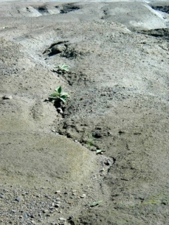 1 1
 2 2
|
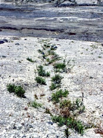
[1] Microtopography created by a rill on volcanic ash in Mount Usu after the 1977-78 eruptions Polygonum sachalinense seedlings established more in rill inside (Haruki & Tsuyuzaki 2001). [2] Microtopography, e.g., rill, determines plant distribution. Plants established mostly in the rill inside. Photo taken on Mount St. Helens on August 1993.
|