(Upload on November 4 2017) [ 日本語 | English ]
Mount Usu / Sarobetsu post-mined peatland
From left: Crater basin in 1986 and 2006. Cottongrass / Daylily
HOME > Lecture catalog / Research summary > Glossary > Geography
[Japan, Hokkaido] [geomorphology · geoecology]
|
Human geography (人文地理学): a branch of the social sciences related to the world, its people, communities and cultures
economic geography
geomorphology |
|
|
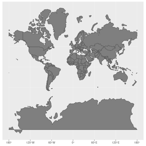
Symbolic depiction highlighting relationships between elements of some space, such as objects, regions, and themes.
[ natural science ] History of mapThales (BC624-BC526): BC5c gnomonic or central projection (心射図法)Eratosthenes (BC275-BC194), Ancient Greek
measured the circumference of the earth orthographic projection (正射図法) Hipparchos (BC190?-BC125?), Ancient Greek: BC late-2Cstereographic projection (平射図法) ⇒ applied to sundial, star chart, etc.Marinus of Tyre (70?-130?), Greek? equirectangular projection (正距円筒図法) The Age of Navigation (16th-17th Century) - need (world) mapsStab, Johann (Stabius, Johannes, 1460―1522, Austria) Werner, Johannes (1468-1522, Germany) → Stab-Werner projection Apian, Peter (Bienewitz, 1495-1552)
1530 used Stab-Werner projection for world map 1531 used Stab-Werner projection for (semi-)world map applied by Mercator (1538) |
Mercator, Gerhardus (1512-1594) Flemish (Belgium) geographer and cartographer Mercator projection (1569) Nova et Aucta Orbis Terrae Descriptio ad Usum Navigantium Emendate Accommodata a cylindrical map projection → standard map for navigation
Wright, Edward (1558-1615): showing the drawing by the projection published atlas "Theatrum Orbis Terrarum" (1570) Cossin, Jean (France): used Sanson projection (1570)Sanson, Nicholas (1600―1667, France): used this projection (1650) Bonne, Rigobert (1727-1795): Bonne projectionDe l'Isle, Joseph Nicolas (1688-1768) Mollweide, Karl Brandon (1774-1825): Mollweide projection (1805) von Hammer, Ernst (1858-1925): Hammer projection (1892) Eckert, Max (1868-1938): Eckert projection (1906) Winkel, Oswald (1873-1953): Winkel projection (1921) Goode, John Paul (1862-1932): homolosine projection and Goode projection (1923) Miller, Osborn Maitland (1897-1979): Miller projection (1942)Robinson, Arthur H. (1915-2004): Robinson projection (1974) late 20th c (developing computer and satellite technology) Colvocoresses, Alden P. (1918-2007)
(universal) oblique Mercator projection (1974) |
Mercator projection (メルカトル図法)1569 proposed by Mercator
cylindrical map projection |
Mollweide projection (モルワイデ投影図法)= Babinet projection, homalographic projection, homolographic projection and elliptical projectionan equal-area, pseudocylindrical map projection often used for night sky Universal transverse Mercator projection, UTM1947 proposed by the headquarters of United States Army Corps of Engineers (USACE)the Transverse Mercator projection to mapping the world, using 60 pre-defined standard zones to supply parameters Lambert conformal projection (ランベルト正角図法)Petas projection (ペータース図法) |
Database5 Free Global DEM Data Sources – Digital Elevation Models |
[biodiversity hotspots, biome, volcanoes]
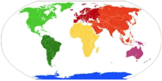
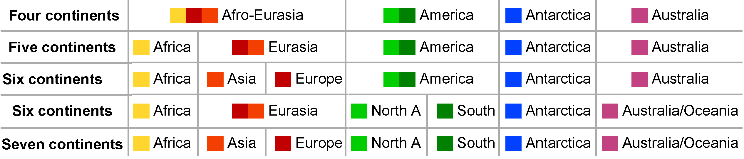
Classification of continents
|
OceaniaMelanesia + Micronesia + Polynesia + Australasia |
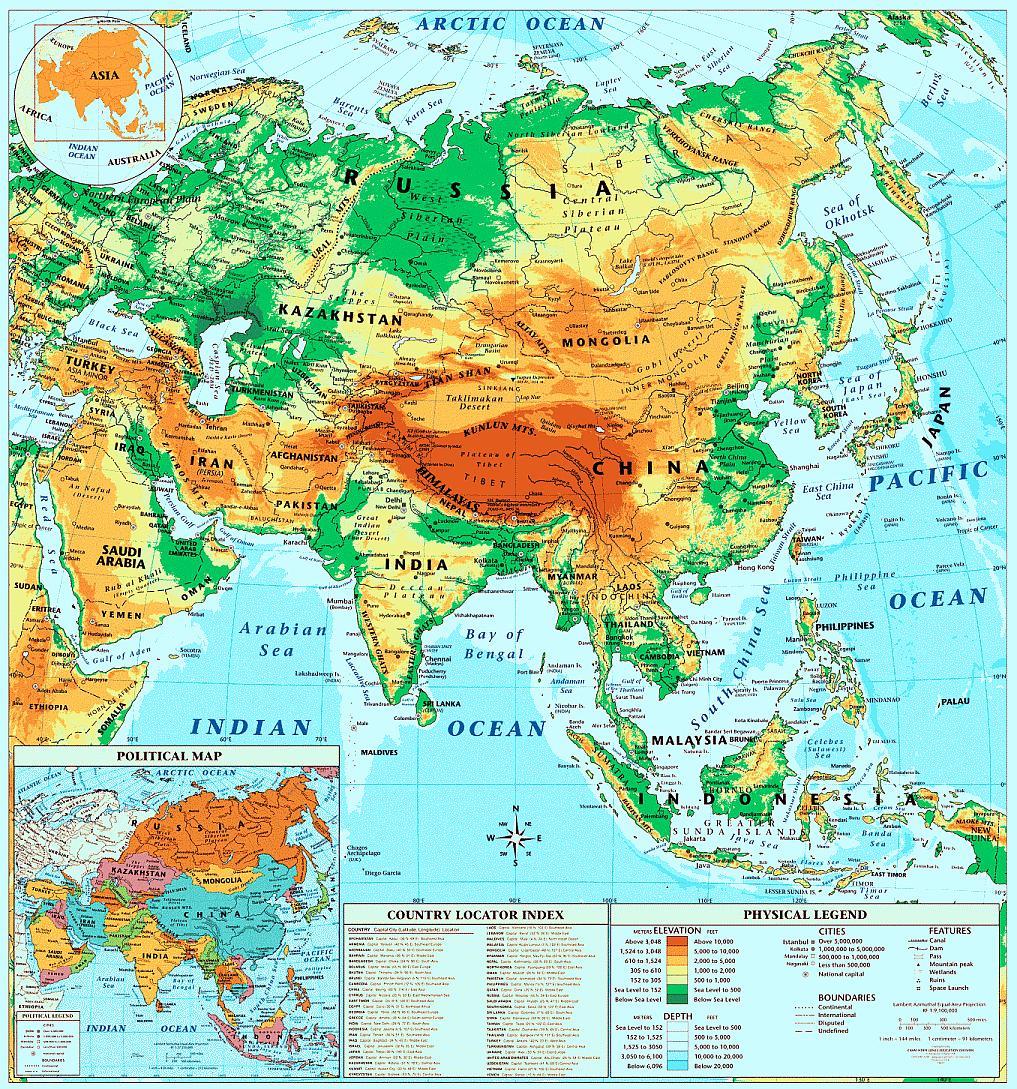
ChinaBeijing Olympic GamesZhangjiakou (张家口) Shenyang (沈阳) Chongli (崇礼)*Hebei (河北) Thaiwoo (太舞)* Wanlong (万龙) Genting (云顶)* Taizicheng (太子城) (*:ski resort) Wuhan (武漢)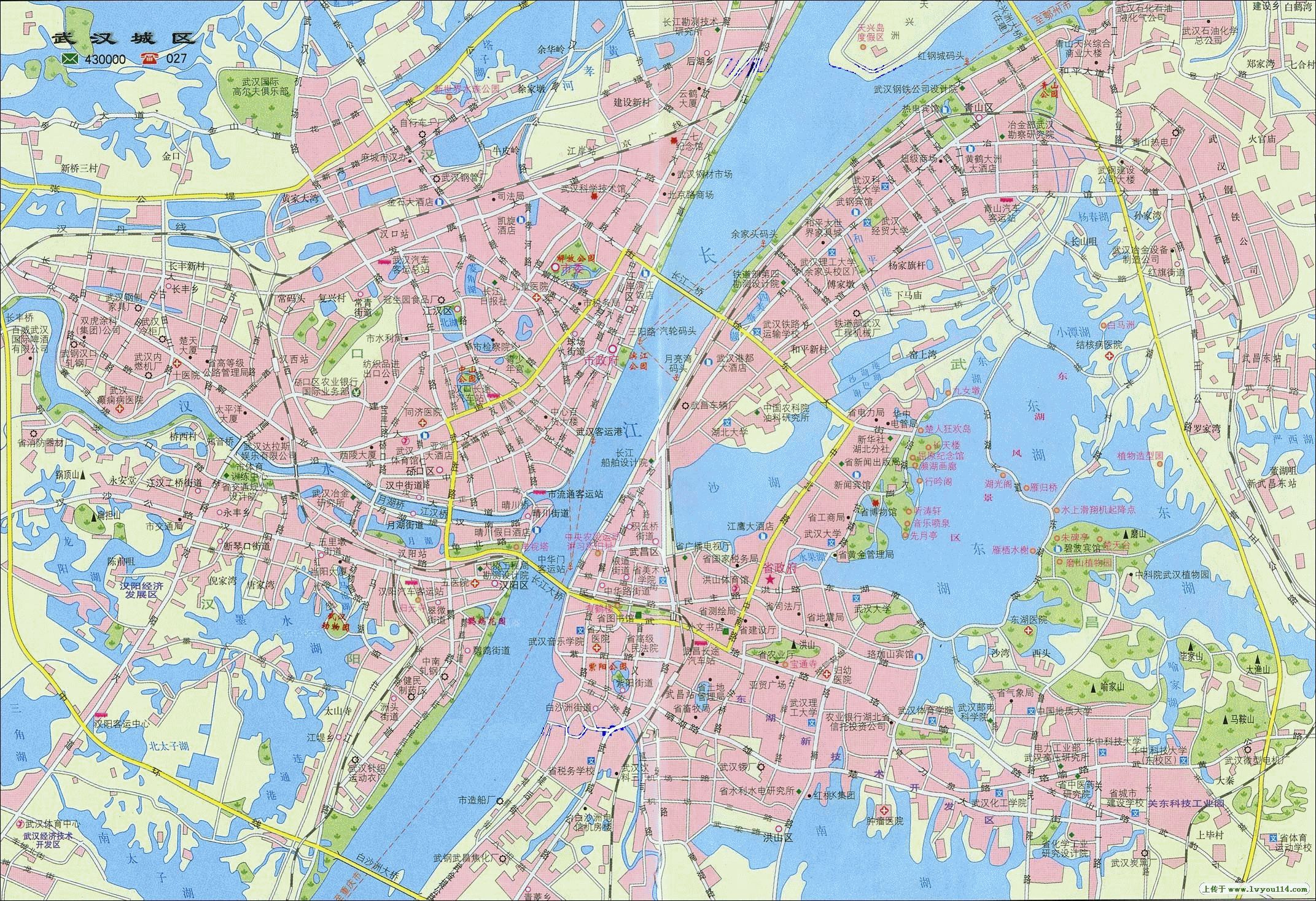 GeoparksLeye-Fengshan Geopark-P.R.China (中国乐山凤山世界地质公园), located in northwestern Guangxi, southwest ChinaShambhala (シャンバラ)Tibetan Buddhism: an ideal Buddhist kingdom described in the Kalacatantrareduction of disaster, such as volcanic eruptions and tsunami, and seclusion
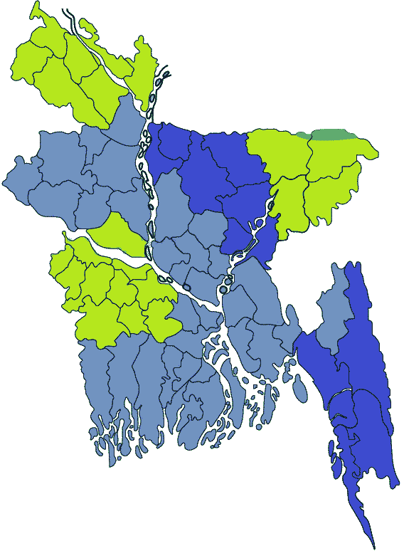
BangladeshIt was the West Pakistan when I was an elementary school studentCapita = Dhaka (largest in the country) Population (2015) = ca 170 million → density = 1034/km² Geography = largely dominated by the fertile Bengal delta Social problems =
political instability 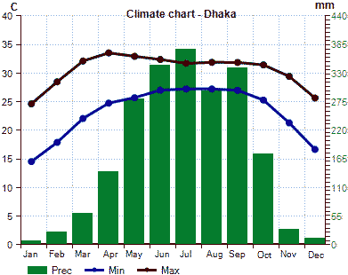
Purbachal New Town Project24.9 km2Sal forest in Purbachal Sal: Shorea robusta Roth Sal forest: 122 ha in 2002 → 41 ha in 2014 |
Pakistan= Islamic Republic of PakistanSoutheastern AsiaKhmer Empire or Angkor Empire (802-1218)origin of CambodiaAngkor Wat: 162.6 ha - ditch-enclosed castle Sukhothai dynasty (≈1240-1438)the oldest dynasty established by Tai peoples in the present Thailandstrong buddhist faith - one cause of decline Ayutthaya dynasty (1351-1767)Tai peoplessupported by international trade Pagan kingdom, empire or dynastyBamar peoplethe first Burmese kingdom to unify the regions (Myanmar in the present) 1044-1077 Anawrahta, Minsaw, reigned (founder) 1314 demolition Indonesia (インドネシア)Indonesia Natural History National Museum (Museum Nasional Sejarah Alam Indonesia, MUNASAIN) on January 25 2018Biological Indonesia (Hayati Indonesia)Flora: Taxon (Indonesia / World (dunia) × 100, %)a. Spore plant (91,251/1,560,500 = 6 1. Cryptogame (Kriptogam)
- Mushrooms (Jamur) (86,000/1,500,000 = 6) 750,000 (Micro 64,000 identified (diidentifikasi). Macro 16,000)
- Lichens (Lichen) 595/20,000 = 3 b. Seed plant 19,232/251,000 = 8 1. Gymnospermae 120/1,000 = 12 2. Angiospermae 250,000 (identified 19,122, 8 probably 30,000-40,000) Decrease in forests and era of wood industries in IndoensiaIn 19th century, most of Indonesian land, i.e., 193.7 million ha was covered by forests (MacKinnon 1997)In 1950, 163 million ha (84%) of Indonesian land was still covered by primary and secondary forests; tea, coffee, and rubber plantations (Indonesia Forest Agency 1950)
Deforestation since 1970 (million ha/year)
Collapse of Plywood Wood Industries since 1998 In the early 20th century, forest area was estimated 98 million ha (Wasson & Applegate 2000) Era of oil palm industries since 2005 Imaginary lines underlying bioregion sharing in IndonesiaGaris Imajiner yang Mendasari Pembagian Bioregion di Indonesia
→ vertical distribution of vegetation on Mount Jayawijaya IPB, January 23/24 2018 Hokkaido University Liaison Office in Indonesia: Grand opening studium generale and workshopObjectives of this workshop
|
Micronesiaa subregion of Oceania (composed of thousands of small islands in the western Pacific Ocean)Mariana Islandsa part of Izu-Bonin-Mariana Arc (IBM Arc)Chamorro, a micronesian native, lived - 17C forced relocation to Guam 9C-17C Latte stone (Taga stone) - use unknown Caroline Islands1527 exploration by Diego da Rocha (Portugal) - later, Spanish territory1899 sold to Germany - until first World War 1914 Japanese territory - 1920 territory mandated by Japan After WII: trust territory of the Pacific Islands
1986 Federated States of Micronesia
stoen walls and megalith consisting of a series of small artificial islands linked by a network of canals in a lagoon enclosed by mangroves Melanesiaa subregion of Oceania (from New Guinea island in the southwestern Pacific Ocean to the Arafura Sea, and eastward to Tonga)Polynesiaa subregion of Oceania, made up of more than 1000 islands scattered over the central and southern Pacific OceanEaster Island (Isla de Pascua, Rapa Nui)formed by the eruptions of underwater volcano
The last eruption recorded in 100 Kya Moai: monolithic human figures carved by the Rapa Nui people on Easter Island between 1250 and 1500 → deforestation |
TuvaluSamoa (サモア)Independent State of Samoa (1962) |W171°| American Samoa (territory)Independent State of Samoa, often called as Samoa Capital city: Apia on Upolu Island 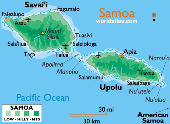 Volcanoes: Savai'i and Upolu 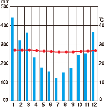 Fig. Monthly precipitation and temperature in Apia Tonga |
|
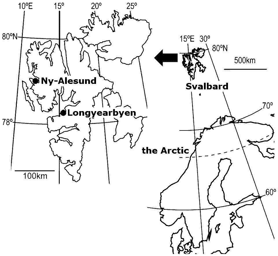
Plants in Svalbard Sanionia uncinata (カギハイゴケ) Cetrariella delisei (トゲエイランタイ) Salix polaris (キョクチヤナギ) Saxifraga oppositifolia (ムラサキユキノシタ) Dryas octopetala (チョウノスケソウ) SpitsbergenThe largest island in Svalbard Islands (N76-81°,)1926 Amundsen. Norge Roald 1926 Byrd, Richard E. |
MountainsAlaskan RangeCoast Ranges___________________________Laurentian Plateau __Cascade Range__Rocky Mountains Sierra Nevada Range_______________Appalachian Mountains __________Sierra Madre Range Alaska (アラスカ)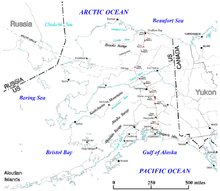
• wildfire (森林火災) NomeFRONT STREET: Front Street has been the business district of Nome since the Gold Rush. In 1900, the street was lined with businesses, bars and bunkhouses. A miner could buy anything, from French lingerie to a hot bath. |
Cascade Range (Cascades, カスケード)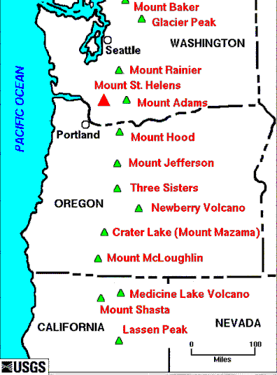
[ plant species | vertical distribution | forest | wetland ] Major Cascade Range volcanoes
Mount St. Helens (セントへレンズ山) Portland, OregonDowntown: ESA meeting in 2017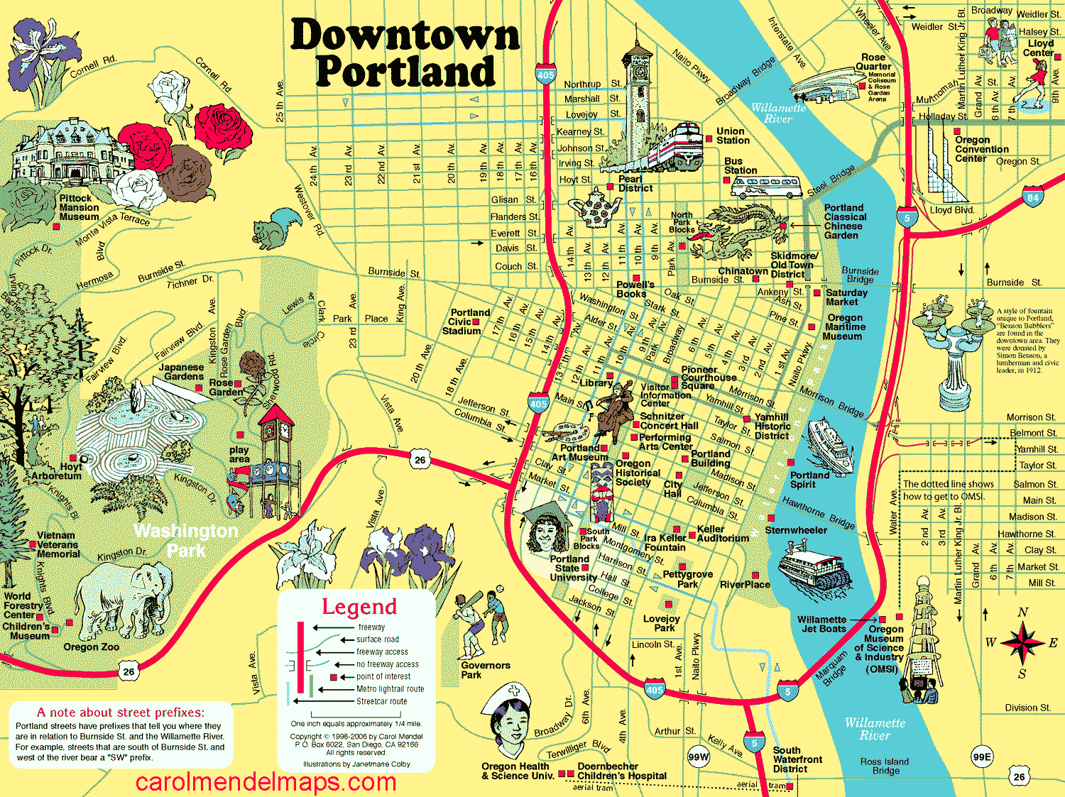
|
Guyana (ガイアナ)= Co-operative Republic of Guyana (Capital: Georgetown)Official languages: English (only this country in South America)
1831 British colony, called British Guiana Galapagos (ガラパゴス)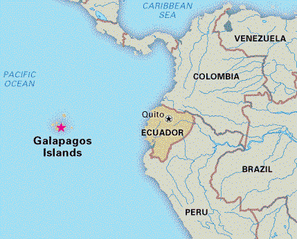 |
Location of Galapagos Islands |
|
The place of origin of humans and the Hominidae clade (great apes) Area: 30,370,000 km2 Language: 1250–3000 native languages Region:
North Africa 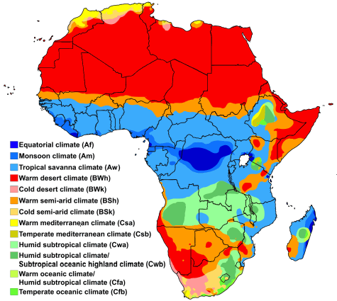 Fig. Köppen climate classification |
Deforestation + soil degradation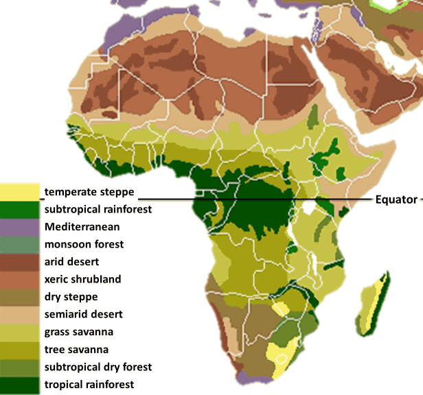
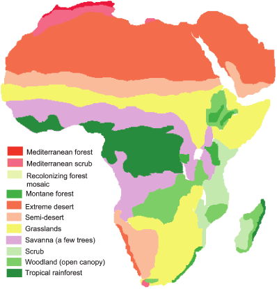
Fig. Present vegetation_____________Fig. Potential present vegetation Ghana Empire (Ghanata or Wagadou)AD1C-AD3C: established
control of the trans-saharan gold trade 1235 submitted to the Mali Empire 1874-1957 British colony |
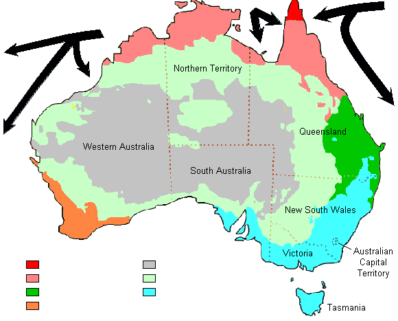
[ Western Australia | Anthem ]
Australasiaa region of Oceania, comprises Australia, New Zealand, neighboring islands in the Pacific Ocean, and sometimes, the island of New Guinea
Tropical rainforest Mediterranean: smoke-induced seed germinaiton |
 Fig. Vegetation formation (Moore & Perry 1970). Arid zone boundary derived from rainfall and evaporation. Nullabor Plain (ナラボー平原)Etymology: nullus (none)+ abor (tree)20000 km2 (1200 km long from east to west) Annual precipitation < 250 mm |
|
= Arctic + Antarctic Def. Arctic: polar region located at the northernmost part of Earth
Arctic Ocean and the adjacent seas
= North Slope Borough, Northwest Arctic Borough, Nome Census Area, and is sometimes taken to include parts of the Yukon-Koyukuk Census Area Subpolar regionaround latitudes 60° to 65° N/S of the Equator |
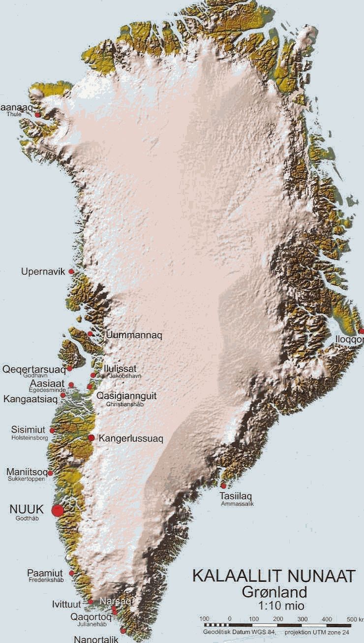
Greenland (グリーンランド)Kalaallit Nunaat (island of human, Greenlandic) - Dominion (自治領) of Denmark |