(Upload on March 22 2025) [ 日本語 | English ]
Mount Usu / Sarobetsu post-mined peatland
From left: Crater basin in 1986 and 2006. Cottongrass / Daylily
Ecological Society of America
Ecological Society of Japan (生態学会)
Botanical Society of Japan (植物学会)
|
International Association for Vegetation Science
Others
|
Used for the poster sessiosn
Tsuyuzaki S (GSEES, HU), Loneragan B (UWA), Vlahos S (WAPL), Mattiske L (Mattiske Co)
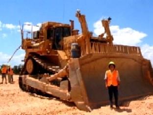
A southwestern region of Western Australia is assigned as a biodiversity hotspot, because of rare and precious ecosystems. This region is also important for the production of bauxite. Therefore, the rehabilitation of ecosystems after bauxite mining is prerequisite for the sustainable management of ecosystems. In the study area, Worsley Almina’s Bauxite Mine, located near Perth, commenced the mining in 1983. The projects on ecosystem rehabilitation started in 1986. The major applications are plantation and seeding of native species. The monitoring of rehabilitated areas has been undertaken using a permanent-plot technique since 1987. Based on the monitoring data, we evaluated species richness and diversity in each plot, and similarity between plots. Temporal changes in life form spectra were examined. Also, detrended correspondence analysis was conducted to investigate temporal changes in community structure. Based on the analysis of the data, we will introduce the outline of rehabilitation status.
Used for the poster sessiosn (2003. Tsukuba)
Titus JH (Biosphere 2 Center, Columbia Univ.) & Tsuyuzaki S* (*GSEES, Hokkaido Univ.)
Mycorrhizae occur in most terrestrial ecosystems and are crucial to understanding community structure and function. However, their role in primary succession is poorly understood. This study examines the mycorrhizal colonization of dominant plant species in relation to microsite types on recent volcanic substrates on the summit of Mt. Koma, Hokkaido, Japan.
MicrositeOn Mount Koma's volcanically devastated summit six common plant species colonized 11 microsite types differentially. Flat sites cover 65%, rills and gullies 16%, and biotic sites 13% of the study area. Most species preferred near rock sites and avoided flat and biotic microsites. Polygonum and Salix preferred gully bottoms and edges. Polygonum and Salix seedlings avoided flat areas, Polygonum seedlings strongly colonized gullies, and Carex oxyandra seedlings preferred Salix patches. Distributions of seedlings and adult plants were correlated. Biotic microsites supported the largest Carex, rills supported the largest Agrostis, and the largest Salix were in gully bottoms and flats (Titus & Tsuyuzaki 2003). |
Mycorrhizal colonizationThe six microsites were flat, rill, near rock, Carex tussock, Polygonum patch and Salix patch. Carex oxyandra was nonmycorrhizal and Agrostis scabra and Campanula lasiocarpa were arbuscular mycorrhizal (AM) at all microsites examined. Agrostis AM colonization levels did not differ across microsites. Near rock Campanula roots contained significantly more hyphae than at flat and Polygonum patch microsites, and rill and Carex tussock Campanula more arbuscules than at Polygonum patches. Penstemon frutescens was found to be facultatively mycotrophic with AM colonization occurring in roots of Penstemon growing in Carex tussocks, Polygonum patches and near rocks. Polygonum weyrichii was found to be ectomycorrhizal. Polygonum located in rills and in Polygonum and Salix patches were more colonized than Polygonum in Carex patches. Salix reinii was heavily ectomycorrhizal (Titus & Tsuyuzaki 2002). |
Aiko Nishimura & Shiro Tsuyuzaki (GSEES, Hokkaido Univ.)
Ca 2700 ha wetland is distributed in Sarobetsu, northern Hokkkaido, Japan. Here, peat with 3-20 ha has been annually mined for using soil-improvement material since 1970. To investigate succession pattern on the mined area, ca 20 1 m × 1 m plots were set up in areas with different ages at about 3-year intervals after the abandonment, with non-mined area used as control. In each plot, species composition and water level were measured. With increasing age, increases in species richosition and environmental factors, i.e., water chemistness and plot cover began ca 10 years after the abandonment. Grass species, Moliniopsis japonica, Rhynchospora alba and Phragmites communis, etc. were dominant 20 years after the abandonment, while peat moss was predominant in the control. Vegetation structrue in the oldest abandoned area differed from that in the control. Of environmental factors, cations, e.g., NH4+ and K+, and total nitrogen in peat water decreased with increasing age. Water level seemed not to be related to the age of abandonment, but affected vegetation structrue. In conclusion, nutrients in peat water was richer soon after the abandonment, and plant establishment was promoted there. However, the vegetation structure was greatly different from the control even on the oldest site. This also may imply that the vegetation change does not go towards Sphagnum mire in the present state (Nishimura et al. 2009).
Shiro Tsuyuzaki (GSEES, Hokkaido Univ.)

Several small-scaled eruptions have made since 1996 on Mount Koma, northern Japan, while this mountain was inactive after the 1929 catastrophic eruption. To clarify the damage of the plant communities and to monitor the dynamics, I set up permanent plots on four locations based on the depths of volcanic deposits produced in 1996, A) non-disturbed, B) slightly-disturbed, C) intermediately-disturbed, and D) intensively-disturbed. I annually monitored those plots up to 2000. The results were as follows (Tsuyuzaki & Hase 2005):