(Upload on May 27 2014) [ 日本語 | English ]
Mount Usu / Sarobetsu post-mined peatland
From left: Crater basin in 1986 and 2006. Cottongrass / Daylily
HOME > Lecture catalog / Research summary > Glossary > Vertical distribution
 Vertical distribution of vegetation (= altitudinal zonation): vegetation occurs at distinct altitudes depending on changes in environmental conditions
altitude, temperature, humidity, soil composition, solar radiation, wind Elevational zonesNival zone (恒雪帯)Alpine (高山帯) --- timber limit (森林限界) --- Subalpine (亜高山帯) Montane (山地帯/低山帯) Submontane zone (亜低山帯) Lowland (山麓帯)
Hilly zone (丘陵帯)  Fig. 1. Classical Humboldt profile of the latitudinal position of altitude belts in mountains across the globe and compression of thermal zones of mountaions, altitude or latitude. Grey is montane, black is alpine, white is the nival belt (Körner 2003) CascadesTable. Altitudinal vegetation zonation on North CascadesElevation (m): Association ___> 1900: Abies-Pinus/Vaccinium deliciosum 1600-1900: Abies lasiocarpa-Larix/Phyllodoce empetriformis-Vaccinium deliciosum 1300-1600: Abies lasiocarpa/Phyllodoce empetriformis _900-1300: Abies lasiocarpa/Pachistima myrsinites __800-900: Abies grandis/Pachistima myrsinites __600-800: Pseudotsuga menziesii/Arctostaphylos uva-ursi ____< 600: Pinus ponderosa-Pseudotsuga menziesii/Agropyron spectabilis  |
[Cascades] Azonal: heavy grazing, fire, soil conditions → non-climax, but stable vegetation e.g., sand dune, salt marsh Jayawijaya Mountains, Indonesiaformaly the Orenge Range4760 m elevation Snow Zone (Zona Salju, ≥ 4600 m): This zone is covered with permanent snow (Zona ini ditutupi oleh salju abadi) Alpine Zone (Zona Alpin, 4100-4500 m): This zone is a rocky desert with moss, moss crust and some phanerogams. (Zona ini merupakan gurun batu dengan lumut, lumut kerak dan beberapa fanerogam, terutama ruput dan teki) Subalpine Zone (Zona Subalpin, 2500-4000 m): At an altitude of 2500-3300 m a.s.l. is dominated by dwarf forests with tall, sparse trees, often mossy or coniferous. While at an altitude of 3400-3600 m a.s.l. is the boundary of forests. At an altitude of 3700-4000 m a.s.l. is dominated by dwarf bushes, patches or conifers. At an altitude of 4000 m a.s.l. is the highest elevation boundary of a single tree. (Pada ketinggian 2500-3300 mdpl didominasi oleh hutan rendah rapat dengan pohon-pohon tinggi menyendiri, sering berlumut atau terdapat konifera. Sedangkan pada ketinggian 3400-3600 mdpl merupakan daerah batas ditemukannya hutan. Pada ketinggian 4000 mdpl merupakan batas elevasi terakhir ditemukannya pohon.) Forest zone (Zona Hutan 1000-1500 m): This zone is a forest area covered with tall trees and relatively poorly moss. (Zona ini merupakan daerah hutan tertutup berbatang pohon tinggi dan relatif miskin lumut) Mountain zone (Zona Pegunungan 1000-1500 m): The zone is inhabited by a high-trunked tree trunk above a 2000 m elevation, with a smaller diameter and more moss. (Zona ini dihuni oleh tertutup berbatang pohon tinggi diatas elevasi 2000 m, dengan diameter yang bertambah kecil dan lumut bertambah banyak.) Lowland (Zona Pamah, 0-1000 m): In this zone, we find out a few types of ecosystems such as mangroves, forests, pamah forests, swamp forests, and forest hills (Pada zona ini dijumpai tipe ekosistem seperti mangrove, hutan, hutan pamah, hutan rawa, dan hutan perbukitan) |
Elevational zones above forest line or tree line
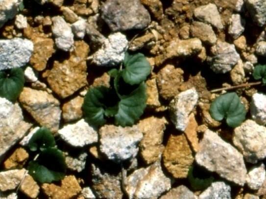
Alpine plants (高山植物)Plants of which major habitats are alpine. Global warming and ozone depletion have strongly struck this zone. In particular, skislpes may be damaged and closed. The pohot shown in right side is one of the alpine plants, Viola kitamiana.Timberline and alpine vegetation in WAThis vegetation may be divided into two broad types: subalpine meadow complexes occur due to heavy snow pack and topographic features, often mixed with tree vegetation. Above this zone is a truly alpine vegetation in which the growing season is everywhere too short for tree growth. All such vegetation requires high elevation. How high depends upon the vegetation is lower than what would be expected on the basis of current climate. In the Olympics, the heavy snow pack acts to limit tree growth; on Mount St. Helens, the youth of the cone (and occasional set backs) precludes a climatic tree line. All the Washington volcanoes, the Olympics, and most of the Cascades have subalpine or alpine meadow vegetation.Elevation: First subalpine meadows begin as low as 1340 m on Mount St. Helens and 1400 m on Mt. Baker and true alpine conditions usually begin above 2100 m or higher. Climate: Short growing season with extensive snow accumulates in western Washington. A. Subalpine Meadows
|
B. Alpine communitiesThe true alpine zone is limited in Washington due to heavy snow packs. Much of it less on recent volcanoes where the substrates are young. These vegetation types are generally found above 2300 m. Snow accumulation and wind, combined with soil factors do much to control distributional patterns. Soil instability is a major feature of alpine vegetation, leading to solifluction terraces and stone stripes, among others. Major studies have been conducted in the North Cascades, Olympics, Mt. Rainier, and the Enchantment Lakes. Typical assemblages include the following from Mt. Rainier, but there are many variants.
Lab-study. High elevation vegetationSpecies are listed below by major habitat types. Study the species demonstrated to learn their identifying traits and to learn some of the common associations to be found in Washington. For each dominant species, try to associate several usual subordinates and to determine the kind of habitat you would find these species. |
Occurs at elevations that might support trees, but do not due to topographic or historical factors. May occur below 1500 m (unusual circumstances), typically around 1750 m.
Distribution: throughout high-elevation habitats of western Washington, with five major types of vegetation, defined by growth-from of the dominant species: Heath Scrub (HS), Lush Herb (LH), Dwarf Sedge (DS), Rawmark (RM) and Grassland (GL).
| Species | HS | LH | DS | RM | GL | Comments |
|---|---|---|---|---|---|---|
| Phyllodoce empetriformis* | x | Acid soil | ||||
| Cassiope mertensiana* | x | Acid soil | ||||
| Vaccinium deliciosum* | x | Burns | ||||
| Luetkea pectinata* | x | x | Dominant in rawmark | |||
| Deschampsia atropurpurea | x | x | ||||
| Polygonum bistortoides* | x | |||||
| Valeriana sitchensis* | x | x | x | |||
| Carex spectabilis* | x | x | x | Late snowmelt | ||
| Lupinus latifolius* | x | |||||
| Carex nigricans* | x | Late snowmelt | ||||
| Potentilla flabellifolia | x | x | ||||
| Annemone occidentalis* | x | x | ||||
| Juncus drummondii | x | x | ||||
| Saxifraga tolmiei* | x | |||||
| Festuca viridula* | x | Mount Rainier | ||||
| Phlox diffusa* | x | |||||
| Aster ledophyllus* | x | |||||
| Agrostis diegoensis* | x | South Cascades |
| Species | LF | DF | PC | WA | TS | FS | PT |
|---|---|---|---|---|---|---|---|
| Empetrum nigrum* | X | ||||||
| Lupinus lepidus* | X | x | X | x | x | x | |
| Arctostaphylos uva-ursi* | X | ||||||
| Solidago spathulata* | X | x | x | ||||
| Juniperus communis | x | ||||||
| Penstemon procerus* | x | x | x | x | x | ||
| Arenaria obtusiloba* | x | x | X | x | |||
| Phlox diffusa* | x | x | x | X | |||
| Phyllodoce glanduliflora* | X | ||||||
| Luetkea pectinata | x | ||||||
| Aster alpigenus | X | x | |||||
| Pedicularis contorta* | X | X | |||||
| Carex nigricans | x | ||||||
| Carex spectabilis | X | ||||||
| Erigeron aureus | x | x | x | x | x | x | |
| Arenaria capillaris* | x | ||||||
| Oxyria digyna | x | ||||||
| Salix barcleyii | x | ||||||
| Salix cascadensis | x |
Typical associations: (Heath Scrub) Phyllodoce empetriformis-Vaccinium deliciosum; Cassiope meertensiana-Phde; Vade; Phem/Lupinus latifolius; (Lush Herb) Valeriana sitchensis-Veratrum viride; Vasi-Lula; Lula-Polygonum bistortoides; Carex spectabilis; (Dwarf Sedge) Carex nigricans; (Rawmark) Luetkea pectinata; Saxifraga tolmiei; (Grassland) Festuca viridula-Lula; Fevi-Aster ledophyllus; Festuca idahoensis-Lupinus lepidus (Olympics).
Occur at high elevations, beyond the climatic limit of tree growth, at least 2000 m or more.
Distribution: poorly developed in Washington, due in part to heavy snow pack in and rarity of high elevation habitats. The alpine zone is steep, rugged and often covered in ice or glaciers. Most of true alpine is on volcanoes, hence soils are poorly developed and disturbance is chronic. Seven typical associations have been recognized on Mount Rainier: Lush Fellfield (LF), Dry Fellfield (DF), Pioneer Cushion Plant (PC), Wet Alpine (WA), Turf Sedge (TS), Forb Stripes (FS), and Pioneer Turf (PT).
Alpine Association in the Mount Stuart Area: Arenaria obtusiloba-Phlox diffusa; Lule-Carex proposita-Penstemon davidsonii; Phlox diffusa-Eriogonum pyrolifolium (widespread); Carex spectabilis-Lule; Casp-Juncus parryi; Carex nigricans-Lupinus latifolius (and others).
[ mixed forest | wind cave ]
|
the zone of plants below tree line on a mountain
Japan: needle-leaved forest (Honshu), or Betula maximowicziana forest (Hokkaido) |
Pseudo-alpine zone (偽高山帯)Dorso-ventral structure of vegetation between Japan Sea and Pacific Ocean sidesThe zone is distributed only in Tohoku District, Japan |
|
= mountain zone (fuzzy term)
Japan: deciduous broad-leaved forest (summergreen forest) |
Submontane zone: zone in the lower slopes of a mountain Premontane zone: zone just below the montane zone |
|
Lowland: a low, generally flat region
Japan: evergreen broad-leaved forest Highland: elevated or mountainous land |
Subtropical zone (亜熱帯) in JapanGenerally, considered to be distributed in the southern parts of Amami-Oshima Island on the Ryukyu Chain, Daito Islands and Bonin Islands |