(Upload on August 13 2025) [ 日本語 | English ]
Mount Usu / Sarobetsu post-mined peatland
From left: Crater basin in 1986 and 2006. Cottongrass / Daylily
HOME > Lecture catalog / Research summary > Glossary > Climate
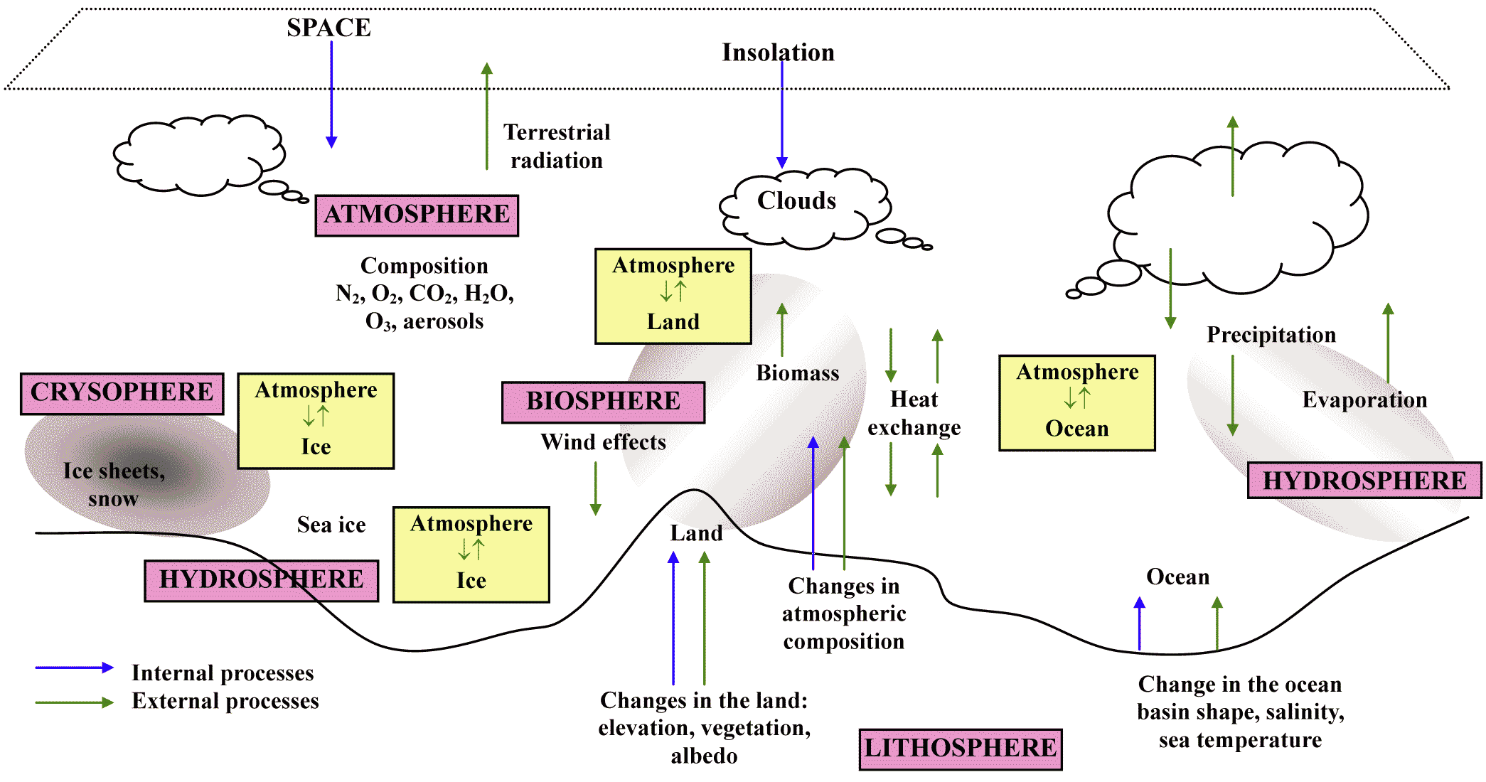
Etymologyklima (Gr.) = inclination Climatic factor (気候因子), yy = f(s, t, a, m, p)
s: solar radiation 日射 |
[electromagnetic spectrum, temperature, cloud, acid rain ] 
|
|
Seasonal change ΔT/Δt = advection (移流量) - sink + source = vertical and horiozontal advection - terrestrial radiation + solar radiation latitudinal and daily fluctuations, in the same way Annual temperatureannual mean temerature (T) and its related variables
monthly mean maximum temperature (月平均最高気温), Tmax |
Warmth index (温量指数)WI = Σ12i=1 (ti > 5), ti = mean monthly temperature > +5°CWI is roughly consistent with the distribution of ecosystems in Japan [cherry blossom front (桜前線)] |
Temperature, T(Kawakita & Kira 1945) Aridity-humidity index (乾湿度指数, K)= P/(WI + 20) (W < 100)= P/(WI + 140) (W > 100) WI: warmth index
< 3.0__3-5____5-7_____7-10__> 10 Thornthwaite climate classificationDef. potential evapotranspiration (最大可能蒸発散量), E or PET:combined loss of water through transpiration (mostly from plants) and evaporation (mostly from soils) Def. TE percent (temperature-evaporation percent) = (T - 32)/4mean annual temperature, T (Fahrenheit, °F): adjusted 0 °C by -32 (un-frozen temperature) Def. TE index = Σn=112(10 × TE percent)(Hamät-ahti et al. 1974) Mean annual biotemperature (年平均生物気温), MABT= Σi=112Pi/12 (case Pi > 0)
→ matched well with Japanese vegetation classification
Precipitation, PPecipitation effectiveness index (降水効果指数, Ep)Ep = Σi=1120.17{Pi/(ti + 12.1)} = 11.5P(T – 10)10/9
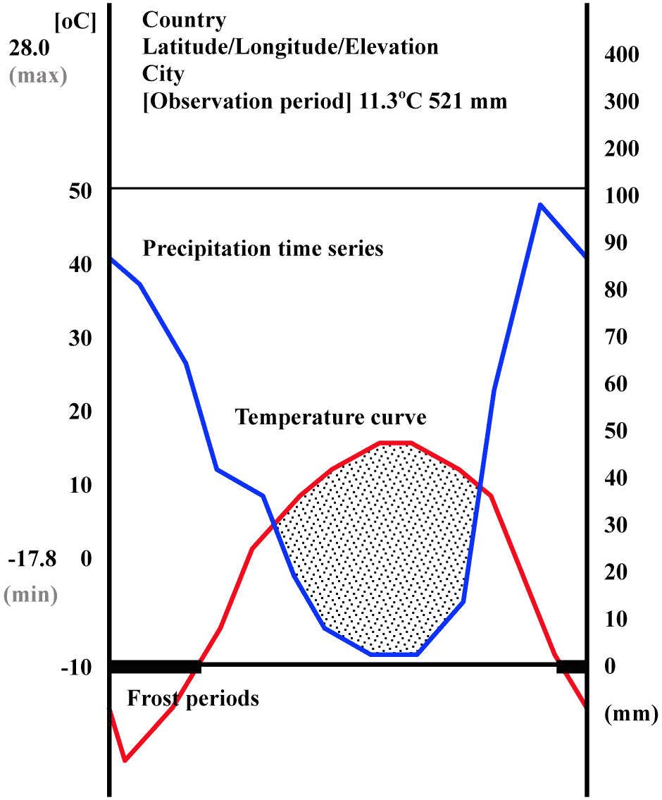
< 128__127-64__63-32__31-16__< 16 Climate diagram (気候ダイアグラム)To express T-P relationships graphically |
Hythergraph (ハイザーグラフ)A climatic graph showing relationships between temperature and humidity or temperature and precipitation
plot monthly data →
August far to the lower left (hot/dry)
Hokkaido climate
January sitting low and far right (cold and snowy) Walter climate diagram (ウォルター気候ダイアグラム)climate chart to visually represent the relationship between monthly temperature and precipitation over the course of a year (Walter Heinrich and Lieth Helmut 1960-1967) (max) mean daily max. temperature of the warmest month (min) mean daily min. temperature of the coldest month |
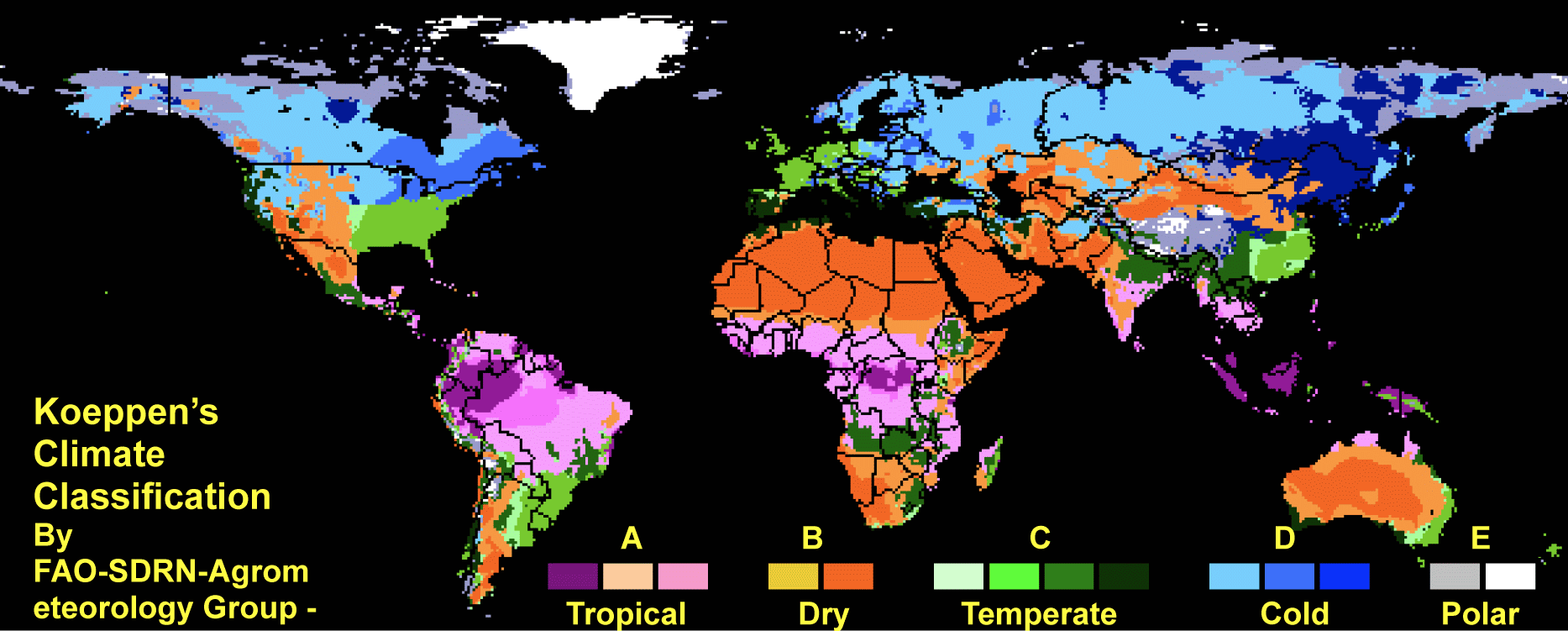
Climate coefficient or climatic coefficient or factor (気候係数)Def. a variable used in different scientific contexts, including applied climatology, to quantify the influence of climate on various phenomena, suc as vegetation distributionEx. Köppen climate classification, pteridophyte coefficient Köppen climate classification (ケッペンの気候区分)= Köppen-Geiger climate classification systemMany reworks after 1884 Group: A: Tropical/megathermal climates B: Dry (arid and semiarid) climates C: Temperate/mesothermal climates D: Continental/microthermal climates E: Polar and alpine climates |

|
Monsoon zoneClimatic features = four seasonsTemperature ⇒ Keep high biodiversity The wide range of yearly "temperatures" Ex. Sakura front (cherry blossom front) Precipitation ⇒ Climax is forests in most regions, because of plenty waterThe large amount of "rainfall" Bai-u or Tsuyu (summer rainy season) From the southern part to northward
Typhoon season (Except Hokkaido) Snow [western and northern Japan, including Hokkaido] |
Climate classification☗ Hokkaido: a humid continental climate with long, cold winter and warm to cool summer,☗ Japan Sea: northwest winter winds bring heavy snowfall. The region is cooler and little less rainy in the summer than the Pacific area, although it sometimes experiences extremely hot temperatures due to the foehn wind ☗ Pacific Ocean: a humid temperate climate that experiences milder winter with occasional snowfall and hot, humid summer because of the southeast seasonal wind. hevy rain in the south, and in the north in the summer days ☗ Inland(Central Highlands): a typical inland humid continental climate, with large temperature differences between summer and winter, and between day and night; precipitation is light, although winter is usually snowy. ☗ Seto Inland Sea: the mountains of the Chugoku and Shikoku regions shelter the Seto Inland Sea from seasonal winds, bringing mild weather year-round and having many sunny days. ☗ Nansei Islands (Southwest Islands): with hot summer and warm winter. It has heavy rain year-round, particularly in rainy season and typhoon season (≈ sub-tropical) |
|
= extreme weather, weather anomalies, climatic anomalies, climatic extremes, and many more unexpected, unusual, severe, or unseasonal weather
lying in the most unusual 10% (10th or 90th percentile of a probability density function) (IPCC 2022) ☛ disaster |
|
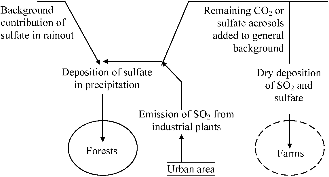
A rain (including fog, snow and other precipitation, s.l.) that is unusually acidic, i.e., pH < 5.6 (or 5.7) Most acid rain is now derived from human activities, in particular, consuming fossil fuels, such as coal and oil SO3 + H2O → H2SO4
NOX (nitrogen oxides) NO2 + OH+ → HNO3 SOX (sulfur oxides) |
Worldwide background of SO2 and sulphate aerosols ----------------------------------------------------------------------------------------------- Fig. 1. Schematic representation of the main components of the atmospheric sulfur budget from synthetic crude oil plants in a northern environment (Hammer 1980) |